



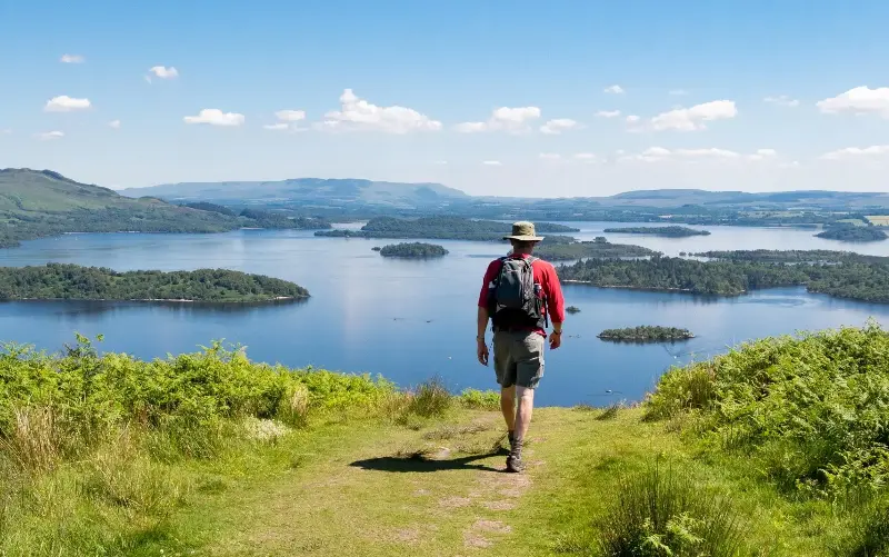
I’ve lived in Bath for 15 years, and often walk a stretch of the Cotswold Way that sweeps splendidly into the city. Back in the day, I’d often not see another soul. These days, I’m rarely alone.
This is an anecdotal observation from one bit of one trail. But it’s a trend borne out by stats: according to the latest Sport England Active Lives report, the number of regular hillwalkers has risen 40 per cent since 2016.
Unfortunately, many walkers are heading for the same hills. Recent footage from Snowdon shows crowds queuing for the summit, while other big-name walks also draw disproportionate numbers. According to the National Trust, Box Hill and Kinder Scout are among its most downloaded walking routes.
But there are thousands of other trails to choose from: more than 140,000 miles of footpaths, bridleways and byways in England and Wales; in Scotland, the right to roam. Here are a few alternative ideas.
Jump to:
South West
Ebbor Gorge, Somerset
Alternative to Cheddar Gorge
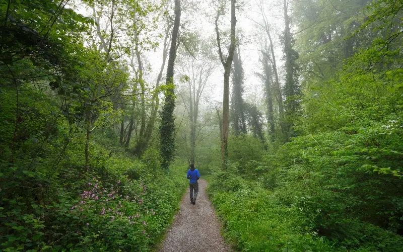
A 122m-deep and three-mile-long gorge slicing through the Mendip Hills, Cheddar is England’s biggest gorge. It’s a splendid sight – though there’s a narrow road twisting through its bottom.
Five miles east, Ebbor Gorge doesn’t have quite the same scale, but it remains unspoilt and a quiet escape from touristy Wookey Hole. The walk in squeezes amid mossy, cave-pocked limestone, where prehistoric peoples once lived, while, from the top, you can look over the rugged defile to see Glastonbury Tor.
A short loop of the gorge can be walked in around an hour; to add interest, extend your walk north to take in the village of Priddy, where Bronze Age tumuli pimple the uplands.
- Start/end: Wookey Hole
- Duration: 6.5 miles; 3-4 hours (2 miles; one hour)
- Route: OS map
- How to do it: The 67 Burnham to Wells bus stops at Wookey Hole. The Swan Hotel has doubles from £109 B&B.
St Aldhelm’s Head, Dorset
Alternative to Lulworth Cove and Durdle Door
Linking a perfectly scooped bay, majestic sea cliffs and an iconic rock arch, the walk between Lulworth Cove and Durdle Door is one of the most popular in the south-west. Just choose a grey Tuesday in November if you want to find a parking spot.
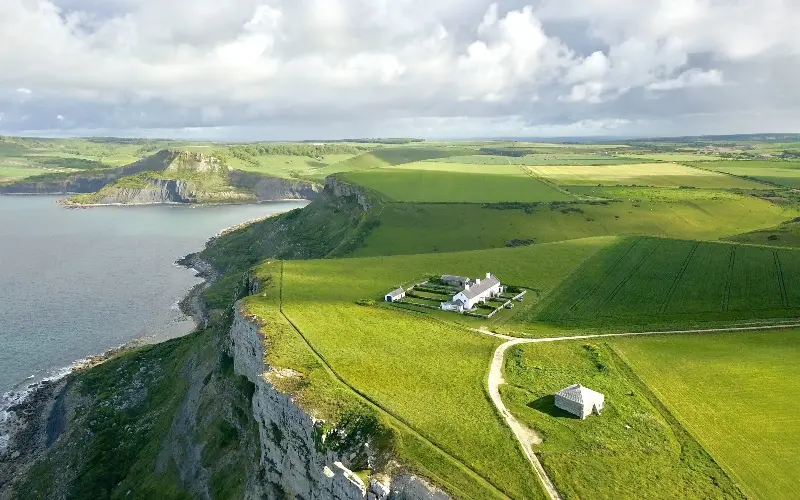
Alternatively, the bulky limestone outcrop of St Aldhelms Head pokes into the English Channel between Lulworth and Swanage, and can be looped from the village of Worth Matravers, using a wild section of South West Coast Path.
The chalk grassland here is a butterfly-fest in summer; you’ll also pass the hewn-out limestone of Winspit Quarry, St Aldhelm’s Chapel (founded in the 13th century), radar station relics and views along the Jurassic Coast. Plus, Worth Matravers has an excellent pub.
- Start/end: Worth Matravers
- Duration: 4.7 miles, 2.5 hours
- Route: OS Map
- How to do it: The 40 Purbeck Breezer bus stops a mile from Worth Matravers. Purbeck Shepherd Huts cost from £143.
South East
Hindhead Commons, Surrey
Alternative to Box Hill
Box Hill is a popular lookout less than 20 miles south of London – and one of the National Trust’s top three walking spots.
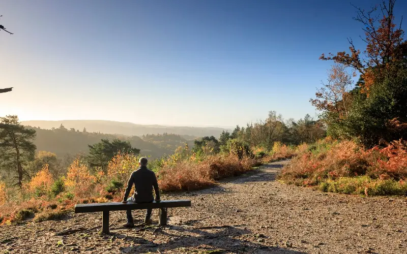
But to avoid the crowds trekking up the hill, the National Trust suggests a “great but demanding” route on Hindhead Commons instead. It’s deeper into the Surrey Hills National Landscape, still has great facilities (café, car park), but isn’t quite so busy.
The full figure-of-eight route takes in the striking amphitheatre of the Devil’s Punchbowl and 892ft Gibbet Hill, Surrey’s second-highest point; halve it for an easier walk. This is also a National Nature Reserve, home to blazing heather in late summer and autumn, plus native trees, Exmoor ponies and ground-nesting birds.
- Start/end: Devil’s Punchbowl car park
- Duration: 6.4 miles; 2.5-4 hours
- Route: OS map
- How to do it: The 19 Aldershot-Haslemere bus stops at Hindhead crossroads. The Merry Harriers, in Hambledon, has doubles from £120 room only.
Wales
Moel Siabod, Eryri
Alternative to Snowdon
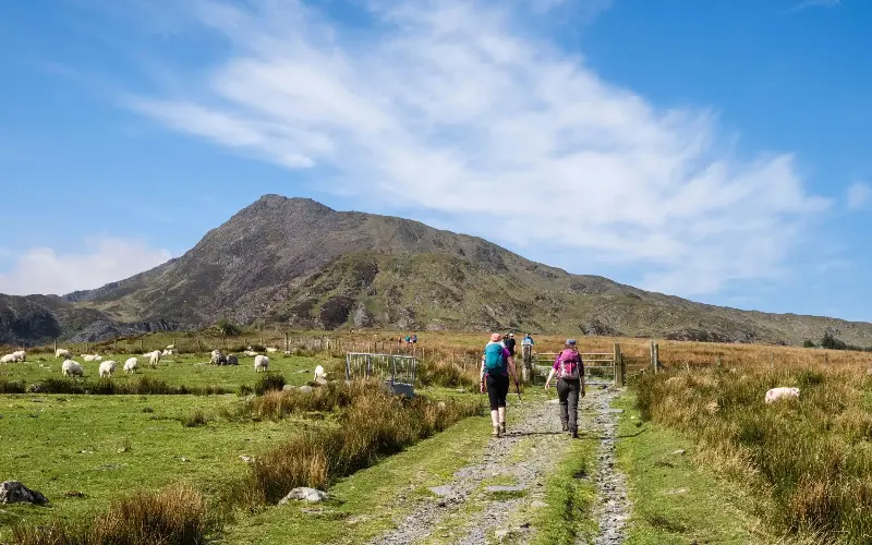
Around 600,000 people climb Snowdon each year. Almost half use the first-timer-friendly Llanberis Path, the “easiest” (though not easy) of the six main routes – though, whichever route you take, the summit can be heaving.
At 2,861ft, Moel Siabod is a relative tiddler compared with Snowdon – but is far less crowded. Standing a little apart from its neighbouring peaks, it’s a little beaut of a mountain, with a wilder, more isolated feel. The most accessible way up starts from Capel Curig, a relatively simple climb, first past waterfalls and then across open moorland, with Snowdon in sight. From the top, on a clear day, there’s a fabulous 360-degree panorama, encompassing the Glyderau range, Tryfan and the Irish Sea.
- Start/end point: Pont-Cyfyng
- Duration: 6 miles; 3.5-5 hours
- Route: OS Map
- How to do it: The S1 Sherpa’r Wyddfa bus serves Capel Curig. The Rocks at Plas Curig is a posh hostel with dorm beds from £39, doubles from £58.
Llyn y Fan Fach, Bannau Brycheiniog
Alternative to Pen y Fan
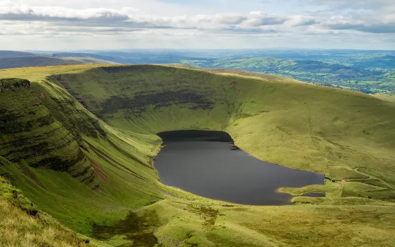
The highest peak in Bannau Brycheiniog, also known as the Brecon Beacons, is one of its most popular walks. Attempt this 2,907ft summit on any half-decent day and the main parking area will be carnage, the way up traffic-jammed. It’s nicknamed “the motorway”.
The sweeping Carmarthen Fans, in Bannau Brycheiniog’s far west, are a far quieter prospect – and home to arguably the park’s best walk. A strenuous loop combines Llyn y Fan Fawr and Llyn y Fan Fach, two dark glacial lakes hemmed in by sweeping cirques; from the top of the ridges, you may get views of Pen y Fan.
A bus-accessible route starts from the south; a slightly shorter walk, which starts alongside a cascading stream, begins from the north, near Llanddeusant.
- Start/end: Tafarn-y-Garreg (or Llanddeusant)
- Duration: 12 miles; 7-8 hours (9.3 miles; 5-6 hours)
- Route: OS Map
- How to do it: The T6 Brecon-Ystradgynlais bus stops at Tafarn-y-Garreg. To start from Llanddeusant, use the Llyn y Fan Fach car park. Y Castell in Llangadog has doubles from £120 B&B.
Midlands
Lantern Pike, Derbyshire
Alternative to Kinder Scout
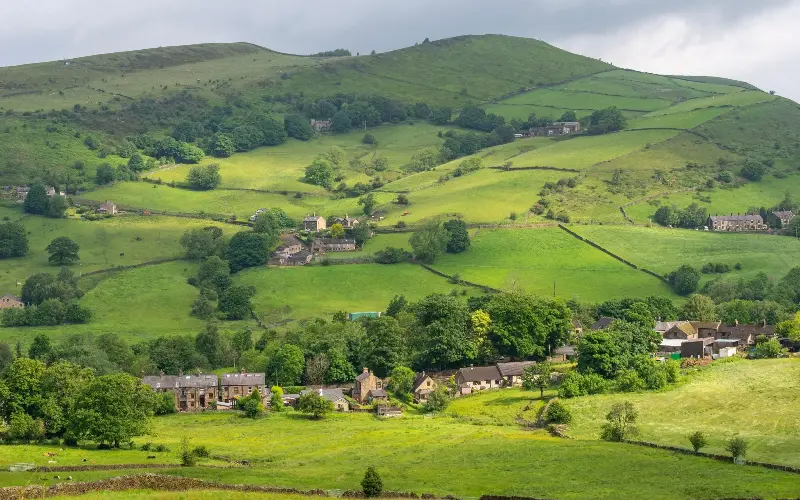
There’s something alluring about the forbidding Peak District plateau of Kinder Scout, site of the infamous mass trespass that kickstarted the move to improve countryside access for all.
The summit ridge of little Lantern Pike (1,224ft) stares right at Kinder’s formidable western edge. You could make a quick walk up from the comely village of Hayfield. Or plot a slightly longer circuit combining a bit of the former Manchester railway, Lantern Pike’s wide-screen perspective, a dip down to Little Hayfield and a stretch across Middle Moor, with its wilder, Kinder-y vibes.
The last leg is along the Snake Path, an old trading route that, in 1897, was kept open to the public following a legal battle – an early milestone for countryside access.
- Start/end: Hayfield
- Duration: 5.5 miles; 3 hours
- Route: OS Map
- How to do it: Various buses serve Hayfield, including services from Stockport and Buxton. The George Hotel has doubles from £85, room only.
Yorkshire
Austwick & Crummackdale, Yorkshire Dales
Alternative to Malham Cove
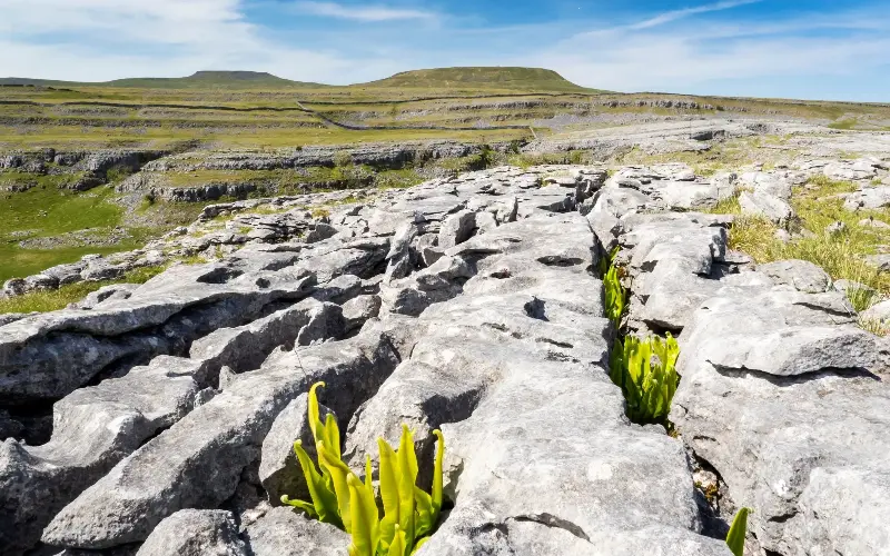
The trails around Malham Cove pack in plenty of natural drama: in under five miles you can link the mighty Ice Age curve, plus Gordale Scar and Janet’s Foss falls. A box-ticker of a route, understandably popular.
Jonathan Smith runs Where2Walk, which focuses on the best walks in the Yorkshire Dales, Lake District and North York Moors. He advises visitors to avoid Malham and, for his money, the Austwick and Crummackdale loop is the best alternative and one of his favourites in the Dales – “a geological lesson come alive”, he reckons.
It offers superb scenery, stretches of limestone pavement and views across to the Yorkshire Three Peaks, plus a lovely village with an excellent pub.
- Start/end: Austwick
- Duration: 8 miles; 3-4 hours
- Route: OS Map
- How to do it: The 581 Skipton-Lancaster bus stops in Austwick. The Traddock in Austwick has doubles from £140 B&B.
North West
St Sunday Crag, Lake District
Alternative to Helvellyn
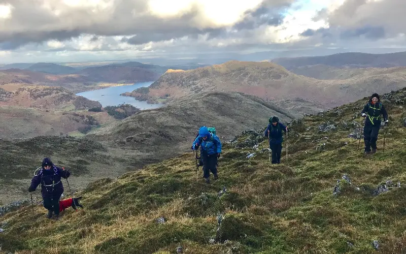
When ITV made a show called Britain’s Favourite Walks, Helvellyn came out on top. And most people’s favourite way of summiting the peak is via Striding Edge, a knife-blade Grade 1 scramble offering high – but congested – adventure.
The rounded 2,759ft-high mass of St Sunday Crag runs parallel to Helvellyn, but you’ll find far fewer people up here. Tackle it on a moderate loop from Patterdale, first ascending the glorious Grisedale valley – Helvellyn on one side, St Sunday’s rugged north-west face to the other.
On reaching the inky waters of Grisedale Tarn, climb up onto the crag itself, following the ridge for splendid views across to Striding Edge and the Helvellyn massif, and down to delightful Ullswater too.
- Start/end point: Patterdale
- Duration: 8 miles, 4-5 hours
- Route: OS Map
- How to do it: The 509 Penrith-Keswick bus runs via Patterdale. Hares Garth, a stone barn for two near Patterdale, costs from £795 per week.
Scotland
Allermuir Hill, Pentland Hills
Alternative to Arthur’s Seat, Edinburgh
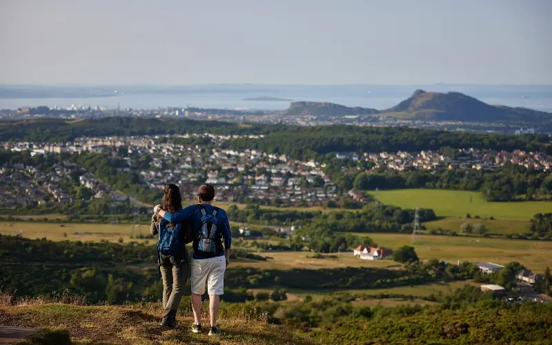
Edinburgh’s extinct volcano is a dark, knobbly beacon to urban adventurers, and surely one of the world’s best city walks, offering a satisfying yomp and wonderful views. Busy, though.
If you want to escape the crowds, head to Allermuir instead. At 493m, it’s the highest of the major peaks in the rolling Pentland Hills, just south of Edinburgh.
Start from Hillend, and climb via the Snowsports Centre to the Caerketton ridge. Beyond a col, the final, steep pull to the summit rewards with sweeping views across the city to the Firth of Forth and over the rippling Pentlands, including Scald Law, their highest point. The descent drops into Swanston, a clutch of thatched cottages where Robert Louis Stevenson once lived as a child.
- Start/end point: Midlothian Snowsports Centre, Hillend
- Duration: 3.8 miles, 2-3 hours
- Route: OS map
- How to do it: Lothian bus 4 runs from central Edinburgh to Hillend. The Secret Hideaway, below the Pentlands, has pods from £210.
Beinn Dubh, Loch Lomond
Alternative to Ben Lomond
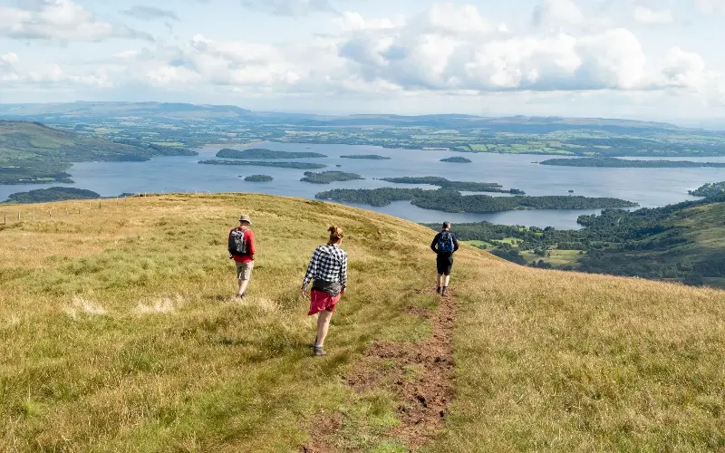
Easily reached, relatively easily climbed and affording spectacular Loch Lomond views from the top, 974m-high Ben Lomond is Scotland’s most southerly Munro and one of the busiest.
Beinn Dubh can’t match Ben Lomond for size, though it’s the highest point of the Glen Striddle Hills, it’s only 2,156ft – a mere “Graham” (mountains between 2,000 and 2,500ft). But that means you won’t be besieged by Munro or even Corbett baggers here.
A loop from the cute conservation village of Luss, around the Glen Striddle horseshoe, is a marvellous, manageable choice, combining woodland trails, open uplands (look for skylarks, red grouse and red deer) and striking views of the more popular Ben, looming across the loch’s island-stippled waters.
- Start/end: Luss
- Duration: 7 miles; 4-5 hours
- Route: OS Map
- How to do it: The E5 Glasgow-Fort William bus stops at Luss. The Lodge on Loch Lomond has doubles from £229 B&B.